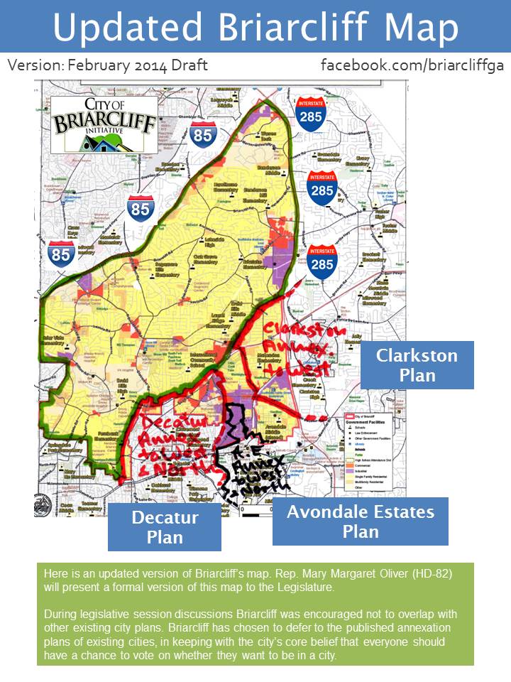
The City of Briarcliff Initiative has released an updated version of the Briarcliff boundaries taking into account proposed annexations by Decatur, Avondale Estates and Clarkston. Rep. Mary Margaret Oliver (HD-82) will present the new map to the Legislatures, but it is uncertain if any action will be taken on cityhood initiatives this session.
The hand-corrected “February 2014 Draft” map shows the proposed city’s new boundary lines in green and the proposed annexations of land in unincorporated DeKalb by the existing cities. Briarcliff would still include all of the Medlock, Mason Mill, and Druid Hills neighborhoods as well as Emory University and the CDC. Interstate I-85 and I-285 remain consistent boundaries and are unchanged. Druid Hills and Lakeside high schools and their middle schools remain in the proposed city.
“We believe that strong cities, both existing and new, are in the best interest of the residents and of DeKalb County as a whole. As many residents of unincorporated DeKalb as possible should be given the opportunity to vote on cityhood, either in a new city referendum or in an annexation vote,” says Allen Venet, President of City of Briarcliff Initiative. “The legislative process remains very fluid, and residents of the affected neighborhoods should continue to express their preferences to their local city and state legislators.”
Oliver commented, “We’re making progress. More people are working together. We have opportunities this session to reach an agreement with our neighbors and move forward.”
Two other cityhood initiatives – Lakeside and Tucker – are also jockeying for position in the Legislature and include some of the territory outlined by Briarcliff.
Comments are closed.