Controversy over a potential widening of Sandy Springs’ Mount Vernon Highway for alternative transportation shifted topics, from a now ruled-out house-takings to transit types, at a Nov. 14 city meeting.
Around 150 people attended the meeting, held at Mount Vernon Presbyterian Church, to hear about the project, which at minimum will add a multi-use path and at maximum, two additional on-street lanes for alternative transportation. Officials from the church’s school and the Sandy Springs Branch Library were among the attendees.

The still-conceptual idea triggered enormous neighborhood controversy in recent weeks as city officials repeatedly said they could not rule out the eminent-domain taking of houses for a future project. Mayor Rusty Paul definitively ruled out such house-takings at the Nov. 14 meeting, while declining to explain why he could not do so just weeks ago or why he can now, and that situation remains mysterious.
“Look me in the eyes. We’re not taking houses,” Paul told at least three residents while taking them by the shoulders.
With that issue apparently off the table, residents still had questions about the amount of right of way that might be needed and about the possible types of alternative transportation in the corridor, which is the section of Mount Vernon between the Sandy Springs MARTA Station and Roswell Road. Alternative concepts include adding up to two on-street lanes exclusively for modes other than single-occupancy motor vehicles, such as bicycles, ride-share cars, shuttle buses or streetcars.
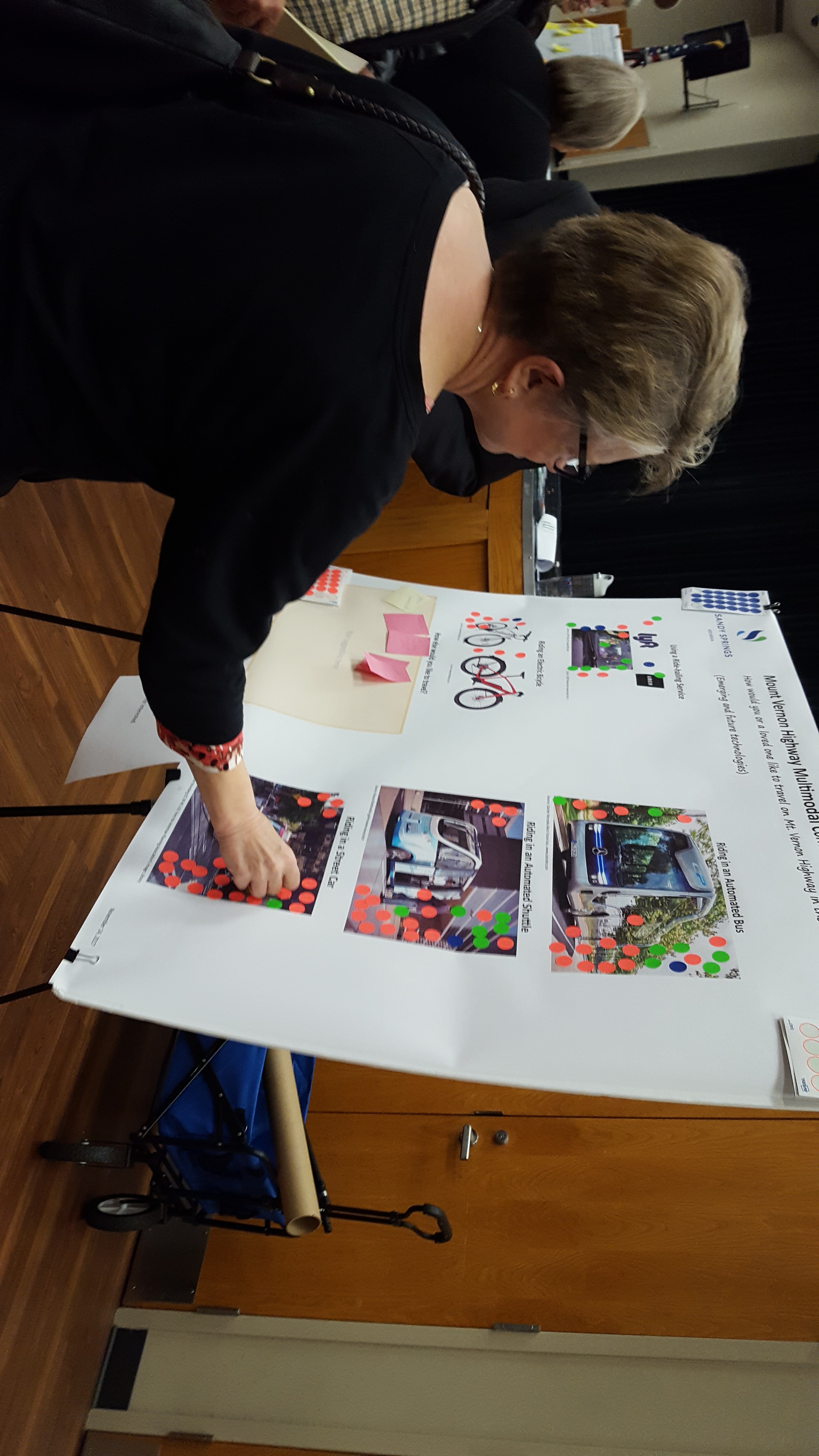
Sticker-voting on display panels by attendees showed a strong preference to keep Mount Vernon car-centric and strong opposition to mass transit. City-hired consultants said in a presentation that they heard similar results from a Sept. 18 “focus group” meeting and a mailed survey that drew 705 responses. They said that while a majority of respondents still want to drive in the corridor, 20 to 25 percent expressed interest in some type of shuttle service, which could significantly reduce traffic.
At the Nov. 14 meeting, residents had concerns about whether any such alternative transportation was intended to serve them or outsiders, and smaller land-taking for right of way remained an issue.
The meeting’s format also drew criticism, with many attendees calling it “insulting” or “disappointing” for lacking a question-and-answer period during a main gathering, which meant that complaints and the mayor’s responses could not be heard by all attendees.
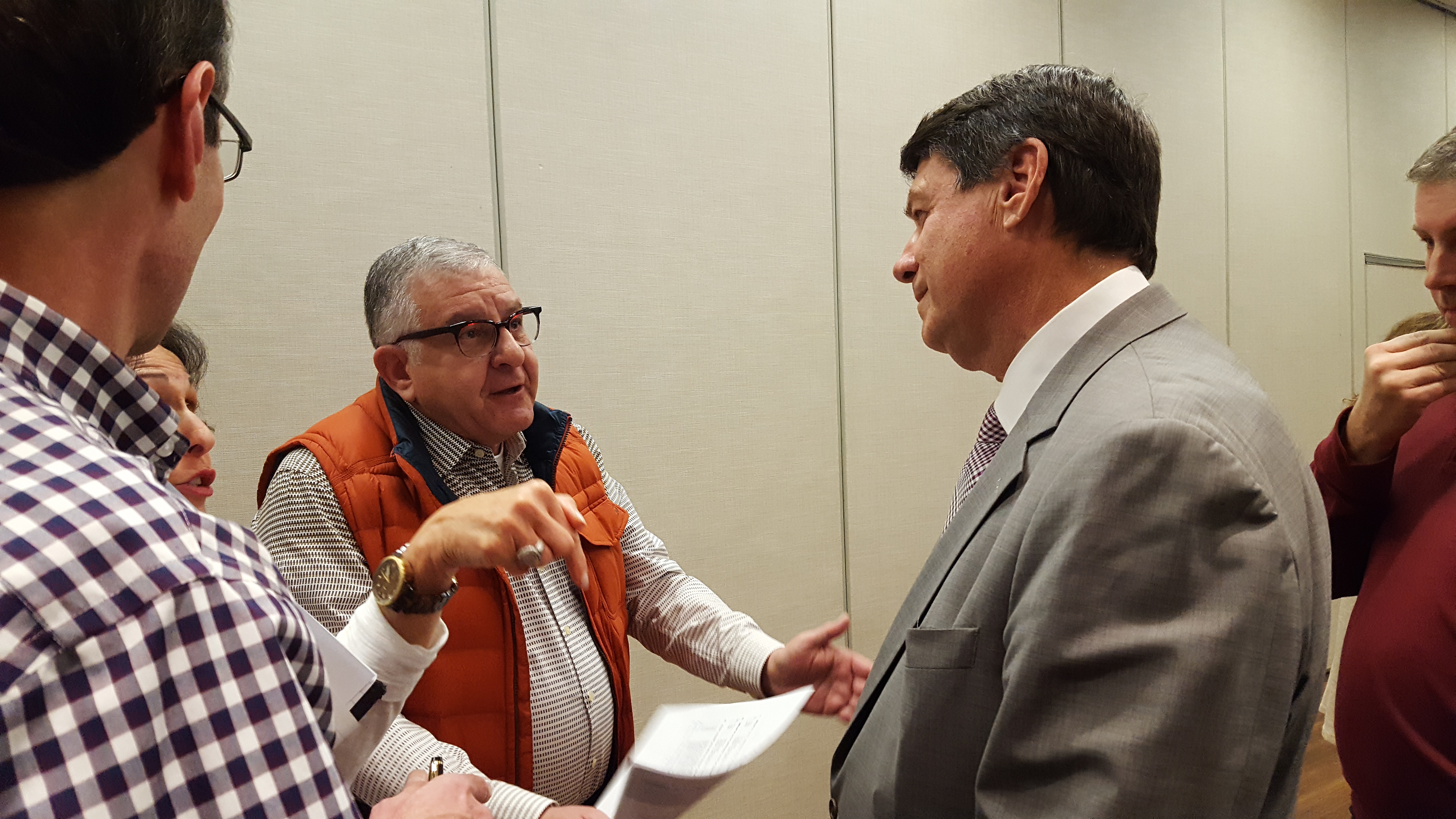
Paul insisted that the meeting was more informative and efficient by holding a presentation and by providing officials at various displays to answer questions. He also stood to the side of a room and spoke directly with about a dozen residents in lengthy conversations, as did City Councilmember Chris Burnett. Also in attendance was City Councilmember-elect Jody Reichel, who said she was still learning about the project and that she believes the “city does a good job listening.”
“We don’t want to give you a final plan and say, ‘Take it or leave it,’” Paul told one attendee, repeatedly assuring residents that their input will count.
Meeting materials are scheduled to be posted on the city website on a dedicated page; click here to see it. Public comments on the current conceptual phase will be taken through Nov. 22 at kwescott@sandyspringsga.gov. Consultants expect to return with draft recommendations in February and finalize a design for City Council consideration in April.
Transportation options
The Mount Vernon concept is a combination of two items on a transportation special local option sales tax project list approved by voters last year. One is a multi-use trail on Mount Vernon, and the other is a study of creating a Perimeter Center trail network that can double as alternative mass transit routes if funding becomes available. East-west transit in the corridor is also mentioned in the recent “Next Ten” city planning vision document that was developed with community input.
By law, those TSPLOST projects must be completed within the next six years, so “we have to do it,” Paul said. But, he explained, there is plenty of room for input on what “it” will be and its effects on surrounding property.
While the TSPLOST and Next Ten got general community support, a question from Mount Vernon residents is whether alternative transportation is intended to serve them or outside commuters. Consultants at the meeting mentioned Perimeter Center employees wanting to lunch on Roswell Road, for example. Paul said he was concerned their presentation gave a “misimpression” and that he believes the goal is to “add options so people living here can go to City Springs,” the new civic center set to open at Mount Vernon and Roswell Road next year.
An advantage of adding one or two “multi-modal” lanes to the street is reserving space for possible future transit, Paul said. He said the city cannot afford mass transit systems at the moment, but technology is rapidly changing, such as the innovation of autonomous buses.
Brian Eufinger, a resident who helped to organize a recent homeowners association about the concept, has raised concerns that such lanes would end up being used by single-occupancy cars in the meantime, and perhaps permanently. City spokesperson Sharon Kraun and Steve Tiedemann, the city’s TSPLOST program manager, say that the lanes would be reserved for alternative transportation modes only and could be used by conventional bicycles or shuttles.
Property-taking concerns
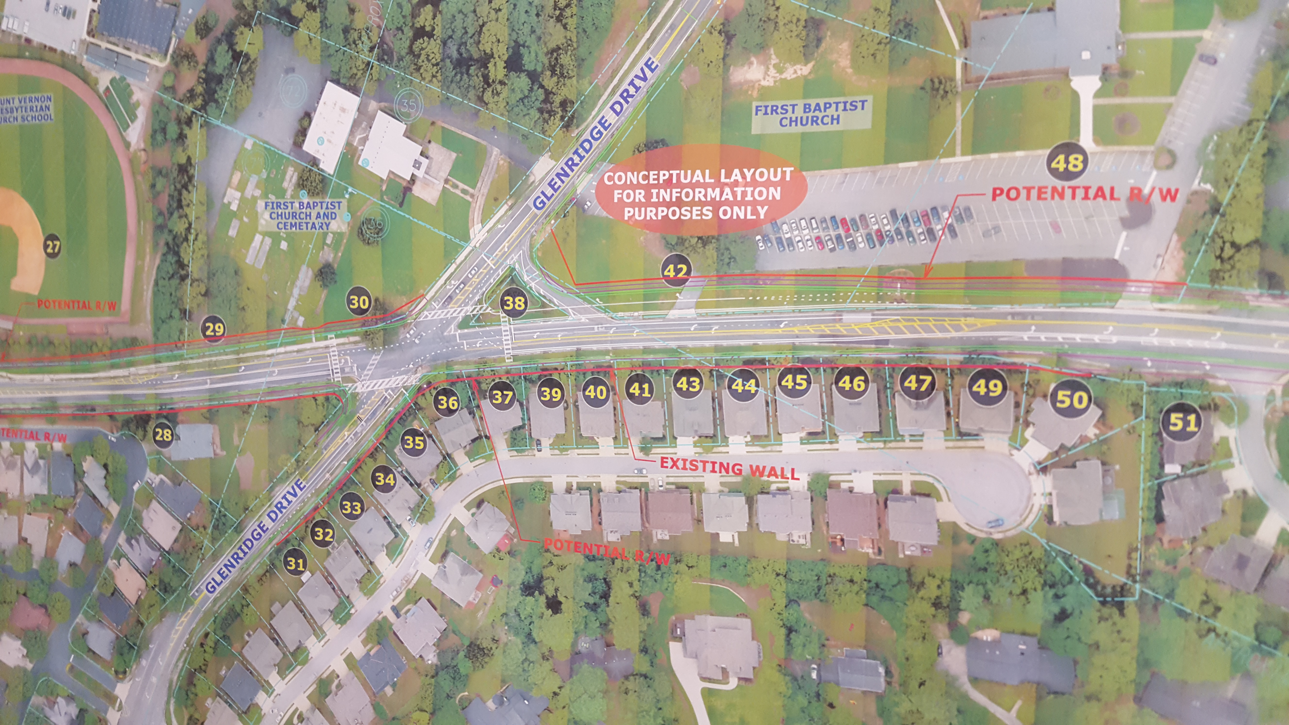
Adding multi-modal lanes would require taking some amount of right of way from yards along the corridor. Early, crude conceptual drawings dating back to January showed possible house-takings. Those drawings became the focus of neighborhood concern in recent weeks, when surveyors began appearing unannounced in local yards and the consultants showed up asking about transit while saying they could not address right of way issues.
City officials repeatedly said they thought house-taking was unlikely, but could not be ruled out in this early stage. Local HOAs held an Oct. 24 meeting where Burnett repeated that stance to an angry crowd. Yet just two days later, Tiedemann said planners already knew they didn’t need to take houses, and that message was confirmed at the Nov. 14 meeting, which included a new map of maximum potential right of way.
It remains unclear why the city’s message changed so abruptly, but there are indications it is a combination of politics and a communications disconnect between the city’s political leaders and its planning staff and outside consultants.
Asked why the city didn’t just rule out house-taking to begin with and when leaders were aware of the new map, Paul paused for several seconds and declined to answer.
“I just don’t think I’m going to ,” Paul said, adding only that earlier information had been presented by someone in a “misleading” way.
Kraun said the possibility of house-taking was effectively dead on arrival when councilmembers greeted it coolly earlier this year. “That was off the table, you could say, in January,” she said, adding half-jokingly that likewise, the possibility is politically dead now “because the mayor said so.”
But on the technical side, she said, city officials hedged in their recent statements because the consultants were still working. She said the City Council still has not been briefed on the project’s current status and that the new right of way map was delivered by consulting firm KCI to the city only on Nov. 10.
Silly me, thinking the roads were public and that everyone has say, not only the people who have property along it…oh well, time to go close off the road in front of my house…none shall pass!
Then again, I wonder how the city can afford to repave my road, I’m sure it’s a few million dollars, and I know me and my neighbors don’t pay that much in taxes. Oh right, it’s a pooled-fund, so we all contribute to benefit each other. So if the 120 properties along Mt Vernon don’t want something that benefits a greater majority…what do we do? Then again, why on earth do I need to give up my property to benefit everyone else?!
*ring ring* It’s the city, hello?
Hi, I’m the property owner you want property from, no way you’re getting it!
Oh, we were willing to pay you for it…
Why didn’t you say so, so I’m going to get compensated for this improvement’s impact to me?
That is how we typically do things…
Gosh, nooooo…you’re the City! You just take! but please make that check out to….
” City spokesperson Sharon Kraun and Steve Tiedemann, the city’s TSPLOST program manager, say that the lanes would be reserved for alternative transportation modes only and could be used by conventional bicycles or shuttles.”
So drivers would obey this rule, much like they obey laws regarding speeding, tailgating, use of lights and signals, distracted driving, drunk driving…